Historic Illinois County Atlases
The digitized content of the Historic Illinois County Atlases consists of atlases of Illinois and several counties and townships from the 19th and early 20th centuries.
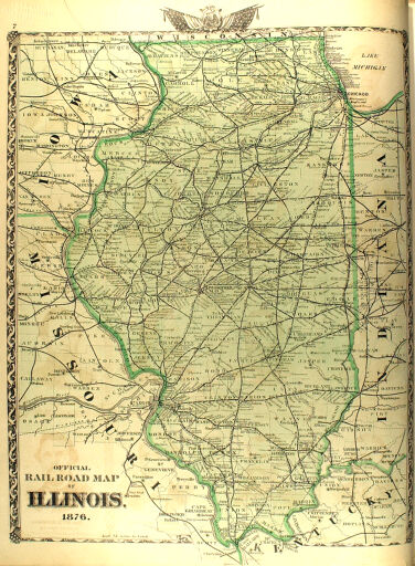
County atlases, which began to be produced after the Civil War, are a uniquely American nineteenth-century publication. County atlas publication initially was centered in Philadelphia in the 1860s, but by the 1880s, Chicago had taken the lead. The atlases provide a snapshot of late 19th-century economics and agriculture. The primary foci of the county atlases are township maps that show property ownership, roads, and railroads. Additional contents might include county, state, and national maps; directories of businesses, county officials, landowners, and rural residents; photographs or drawings of residents, farms, homes, public buildings, churches, businesses, and prize livestock.
The digitized content contains several dozen atlases, most of which were produced in the 19th century. These county and state-wide atlases were compiled from county records and surveys. The atlases include county histories, colored maps, indexes, and some drawings.
The Illinois History and Lincoln Collections unit at the University of Illinois Library manages the physical items included in this Historic Illinois County Atlases collection. A selection of county atlases held in the Illinois History and Lincoln Collections was digitized in the 2010s, with additional atlases digitized in 2022-2024. For more information, contact an archivist at ihlc@library.illinois.edu.