Campus, Community, and State Maps (Digital Surrogates)
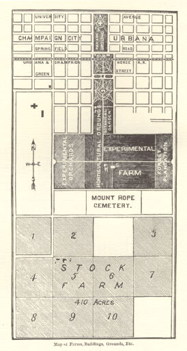
Campus, Community, and State Maps (Digital Surrogates), 1874-2009, includes materials digitized from the University of records series 0/1/807. Digitized materials include the Map of University Property; campus maps with north, south or whole campus views; campus plans and master plans (1986, 1989, 1990, 1996, 1999, 2001 and 2007); maps of campus farms, College of Agriculture buildings, and swine/sheep farms; general campus maps from Engineering, Utility Services, and the Operation and Maintenance Division; campus parking maps with parking regulations; amplified maps of campus sectors; and traffic sign surveys.
An access copy is available in online and nearline files.
Online files: Includes downsampled maps and plans, as well as computer aided desgin files. Materials are arranged in separate folders and are available at the URL listed above.
Nearline files: Original/full resolution copies of all files are available. Please contact the University of Illinois Archives to request access.