


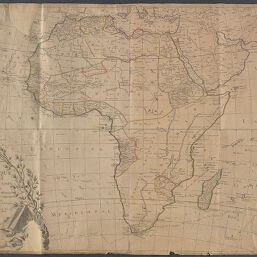
L'Afrique Divisée en Tous ses Etats
Permalink
https://digital.library.illinois.edu/items/0c8ed710-6c98-0134-1deb-0050569601ca-1
This item is in the public domain.
Descriptive Information
| Title | L'Afrique Divisée en Tous ses Etats |
| Creator | Chambon, Gobert-Denis, -1781 |
| Date | 1788 |
| Dimensions | 74 x 104 cm |
| Place of Publication | Paris (France) |
| Cartographic Scale | 1:12,000,000 |
| Notes | See 1754 edition at OCLC No. 762105227 and Gallica GE C-7699. |
| Coverage-Spatial | Africa |
| Genre | Maps |
| Language | French |
| Source | Louis Joseph Mondhare |
| Physical Location | Professor Thomas Bassett Personal Collection |
| Map ID | afm0002422 |
| Rights | No Copyright - United States |
| Rights Description | This item is in the public domain. |
| Collection Title | Maps of Africa to 1900 |
| Repository | Rare Book & Manuscript Library |
| Type | Cartographic material |
| Collection | Maps of Africa to 1900 |
Download Options
|
L'Afrique Divisée en Tous ses Etats |
Contact us
for questions and to provide feedback.