
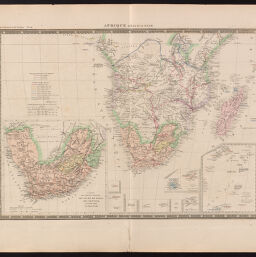
Afrique meridionale
Permalink
https://digital.library.illinois.edu/items/0d7d1ff0-6c98-0134-1deb-0050569601ca-f
This item is in the public domain.
Descriptive Information
| Title | Afrique meridionale |
| Creator | Levasseur, Emile, 1828-1911 |
| Date | 1857 |
| Dimensions | 36.4 x 51 cm |
| Place of Publication | Paris (France) |
| Cartographic Scale | 1:16,000,000 |
| Coverage-Spatial | Africa, Southern |
| Genre | Maps |
| Language | French |
| Source | Atlas Universel de Geographie. Paris: Chales Delagrave |
| Physical Location | Professor Thomas Bassett Personal Collection |
| Map ID | afm0002429 |
| Rights | No Copyright - United States |
| Rights Description | This item is in the public domain. |
| Collection Title | Maps of Africa to 1900 |
| Repository | Rare Book & Manuscript Library |
| Type | Cartographic material |
| Collection | Maps of Africa to 1900 |
Download Options
|
Afrique meridionale |
Contact us
for questions and to provide feedback.