


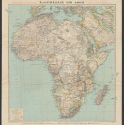
L'Afrique en 1890 : supplément au Figaro du 20 novembre 1890
Permalink
https://digital.library.illinois.edu/items/16d2e4d0-b749-013d-5129-02d0d7bfd6e4-e
This item is in the public domain.
Descriptive Information
| Title | L'Afrique en 1890 : supplément au Figaro du 20 novembre 1890 |
| Creator | Erhard (Firm) |
| Contributor | Thomas J. Bassett Maps of Africa Collection (University of Illinois at Urbana-Champaign Library) |
| Date | 1890 |
| Extent | 1 map : color |
| Dimensions | 58 x 57 cm |
| Place of Publication | Paris (France) |
| Publisher | Hachette (Firm) |
| Cartographic Scale | Scale 1:15,000,000 |
| Cartographic Coordinates | (W 37°40ʹ--E 53°20ʹ/N 42°00ʹ--S 35°00ʹ) |
| Notes |
|
| Coverage-Spatial | Africa |
| Subject | |
| Genre | Maps |
| Language | English |
| Call Number | G8200 1890 .E73 |
| Rights | No Copyright - United States |
| Rights Description | This item is in the public domain. |
| Collection Title | Maps of Africa to 1900 |
| Repository | Rare Book & Manuscript Library |
| Type | Cartographic material |
| Bibliographic Identifier | 9.99556E+16 |
| Collection | Maps of Africa to 1900 |
Download Options
|
L'Afrique en 1890 : supplément au Figaro du 20 novembre 1890 |
Contact us
for questions and to provide feedback.