
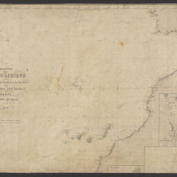
Carte de la côte d'Afrique comprise entre le Détroit de Gibraltar et les Îles de Los
Permalink
https://digital.library.illinois.edu/items/17179910-b749-013d-5129-02d0d7bfd6e4-4
This item is in the public domain.
Descriptive Information
| Title | Carte de la côte d'Afrique comprise entre le Détroit de Gibraltar et les Îles de Los |
| Creator | Robiquet, Aimé |
| Contributor | Thomas J. Bassett Maps of Africa Collection (University of Illinois at Urbana-Champaign Library) |
| Date | 1869 |
| Extent | 1 map on 2 sheets : hand colored |
| Dimensions | 97 x 65 cm, on sheets 50 x 68 cm |
| Place of Publication | Paris (France) |
| Publisher | Robiquet, hydrographe |
| Cartographic Scale | 1:3,205,000 |
| Cartographic Coordinates | (W 26°40ʹ--W 4°40ʹ/N 39°00ʹ--N 9°14ʹ) |
| Notes |
|
| Coverage-Spatial | Atlantic Coast (Africa, West) |
| Genre | |
| Language | French |
| Call Number | G8735 1869 .R62 |
| Rights | No Copyright - United States |
| Rights Description | This item is in the public domain. |
| Collection Title | Maps of Africa to 1900 |
| Repository | Rare Book & Manuscript Library |
| Type | Cartographic material |
| Bibliographic Identifier | 99955571825705899 |
| Collection | Maps of Africa to 1900 |
Download Options
|
99955571825705899-00000001 | |

|
99955571825705899-00000002 | |

|
99955571825705899-00000003 |
Contact us
for questions and to provide feedback.