
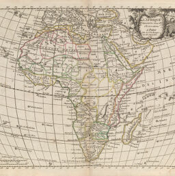
Afrique
Permalink
https://digital.library.illinois.edu/items/21057290-e946-0133-1d3d-0050569601ca-a
This item is in the public domain.
Descriptive Information
| Title | Afrique |
| Creator | Le Rouge, George Louis |
| Date | 1748 |
| Dimensions | 22.7 x 28.8 cm |
| Place of Publication | France |
| Cartographic Scale | 1:42,000,000 |
| Coverage-Spatial | Africa |
| Genre | Maps |
| Language | French |
| Source | Nouvel atlas, V. 1, plate 7. |
| Physical Location | rbx and loose sheet: G83001748L4 |
| Map No. in Bassett and Scheven Bibliography | 81 |
| Call Number | X912L56A |
| Map ID | afm0000082 |
| Rights | No Copyright - United States |
| Rights Description | This item is in the public domain. |
| Collection Title | Maps of Africa to 1900 |
| Repository | Rare Book & Manuscript Library |
| Type | Cartographic material |
| Collection | Maps of Africa to 1900 |
Download Options
|
Afrique |
Contact us
for questions and to provide feedback.