
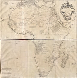
Afrique
Permalink
https://digital.library.illinois.edu/items/212e8df0-e946-0133-1d3d-0050569601ca-7
This item is in the public domain.
Descriptive Information
| Title | Afrique |
| Creator | Santini, P. |
| Date | 1783 |
| Dimensions | 49.8 x 96.5 cm |
| Place of Publication | Italy |
| Cartographic Scale | 1:8,250,000 |
| Notes | Has inset map of the Cape of Good Hope. |
| Coverage-Spatial | Africa |
| Genre | Maps |
| Language | French |
| Color | Hand colored |
| Source | Atlas universel, dressé sur les meilleures cartes modernes, plate 39 2d. |
| Physical Location | maos |
| Map No. in Bassett and Scheven Bibliography | 115 |
| Call Number | F_912SA59A |
| Map ID | afm0000115 |
| Rights | No Copyright - United States |
| Rights Description | This item is in the public domain. |
| Collection Title | Maps of Africa to 1900 |
| Repository | Rare Book & Manuscript Library |
| Type | Cartographic material |
| Collection | Maps of Africa to 1900 |
Download Options
|
Afrique |
Contact us
for questions and to provide feedback.