
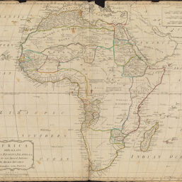
Africa With All Its States, Regions, Islands, etc.: From the Most Approved Authorities
Permalink
https://digital.library.illinois.edu/items/2137f7f0-e946-0133-1d3d-0050569601ca-b
This item is in the public domain.
Descriptive Information
| Title | Africa With All Its States, Regions, Islands, etc.: From the Most Approved Authorities |
| Creator | Kitchin, Thomas, 1718-1784 |
| Date | 1794 |
| Dimensions | 44 x 53.8 cm |
| Cartographic Scale | 1:20,500,000 |
| Coverage-Spatial | Africa |
| Genre | Maps |
| Language | English |
| Source | Loose sheet |
| Physical Location | rbx |
| Map No. in Bassett and Scheven Bibliography | 126 |
| Call Number | G83001794_L3 |
| Map ID | afm0000126 |
| Rights | No Copyright - United States |
| Rights Description | This item is in the public domain. |
| Collection Title | Maps of Africa to 1900 |
| Repository | Rare Book & Manuscript Library |
| Type | Cartographic material |
| Collection | Maps of Africa to 1900 |
Download Options
|
Africa With All Its States, Regions, Islands, etc.: From the Most Approved Authorities |
Contact us
for questions and to provide feedback.