
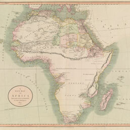
New Map of Africa From the Latest Authorities
Permalink
https://digital.library.illinois.edu/items/214bc170-e946-0133-1d3d-0050569601ca-8
This item is in the public domain.
Descriptive Information
| Title | New Map of Africa From the Latest Authorities |
| Creator | Cary, John, approximately 1754-1835 |
| Date | 1805 |
| Dimensions | 47 x 52.8 cm |
| Cartographic Scale | 1:19,250,000 |
| Coverage-Spatial | Africa |
| Genre | Maps |
| Language | English |
| Source | Loose sheet |
| Physical Location | rbx |
| Map No. in Bassett and Scheven Bibliography | 141 |
| Call Number | G83001805_C3 |
| Map ID | afm0000141 |
| Rights | No Copyright - United States |
| Rights Description | This item is in the public domain. |
| Collection Title | Maps of Africa to 1900 |
| Repository | Rare Book & Manuscript Library |
| Type | Cartographic material |
| Collection | Maps of Africa to 1900 |
Download Options
|
New Map of Africa From the Latest Authorities |
Contact us
for questions and to provide feedback.