
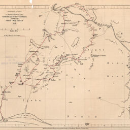
Western Africa, to illustrate Travels in the Yoruba and Nupe Countries, Performed by Daniel J. May Esqr. R.N. 1858
Permalink
https://digital.library.illinois.edu/items/2167cc20-e946-0133-1d3d-0050569601ca-d
This item is in the public domain.
Descriptive Information
| Title | Western Africa, to illustrate Travels in the Yoruba and Nupe Countries, Performed by Daniel J. May Esqr. R.N. 1858 |
| Creator | Royal Geographical Society (Great Britain) |
| Date | 1860 |
| Dimensions | 19.2 x 23.5 cm |
| Place of Publication | England |
| Cartographic Scale | 1:1,700,000 |
| Coverage-Spatial | Africa, West |
| Genre | Maps |
| Language | English |
| Source | Journal of the Royal Geographic Society, V. 30, between pp. 212-213. |
| Physical Location | rbx |
| Map No. in Bassett and Scheven Bibliography | 2223 |
| Call Number | 910_6ROJ |
| Map ID | afm0002223 |
| Rights | No Copyright - United States |
| Rights Description | This item is in the public domain. |
| Collection Title | Maps of Africa to 1900 |
| Repository | Rare Book & Manuscript Library |
| Type | Cartographic material |
| Collection | Maps of Africa to 1900 |
Download Options
|
Western Africa, to illustrate Travels in the Yoruba and Nupe Countries, Performed by Daniel J. May Esqr. R.N. 1858 |
Contact us
for questions and to provide feedback.