
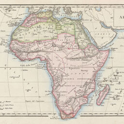
Africa
Permalink
https://digital.library.illinois.edu/items/216bbc40-e946-0133-1d3d-0050569601ca-3
This item is in the public domain.
Descriptive Information
| Title | Africa |
| Creator | Rossari, Carlo |
| Date | 1824 |
| Dimensions | 20.3 x 31.7 cm |
| Place of Publication | Italy |
| Cartographic Scale | 1:41,000,000 |
| Notes | Cleaned with brush or eraser. |
| Coverage-Spatial | Africa |
| Genre | Maps |
| Color | Hand colored |
| Source | Nuovo atlante, plate 30. |
| Physical Location | maos |
| Map No. in Bassett and Scheven Bibliography | 167 |
| Call Number | Q_912R73N1824A |
| Map ID | afm0000167 |
| Rights | No Copyright - United States |
| Rights Description | This item is in the public domain. |
| Collection Title | Maps of Africa to 1900 |
| Repository | Rare Book & Manuscript Library |
| Type | Cartographic material |
| Collection | Maps of Africa to 1900 |
Download Options
Contact us
for questions and to provide feedback.