
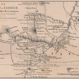
Das Ghurian-Gebirge nach Dr. Barth's Messungen
Permalink
https://digital.library.illinois.edu/items/2170a970-e946-0133-1d3d-0050569601ca-d
This item is in the public domain.
Descriptive Information
| Title | Das Ghurian-Gebirge nach Dr. Barth's Messungen |
| Creator | Petermann, A. (August), 1822-1878 |
| Date | 1857 |
| Dimensions | 8.7 x 13 cm |
| Cartographic Scale | 1:500,000 |
| Coverage-Spatial | Africa, West |
| Genre | Maps |
| Language | German |
| Color | Bitonal |
| Source | Petermanns geographische Mitteilungen, V. 3, plate 9. |
| Physical Location | stx |
| Map No. in Bassett and Scheven Bibliography | 2216 |
| Call Number | Q_910_5PE |
| Map ID | afm0002216 |
| Rights | No Copyright - United States |
| Rights Description | This item is in the public domain. |
| Collection Title | Maps of Africa to 1900 |
| Repository | Rare Book & Manuscript Library |
| Type | Cartographic material |
| Collection | Maps of Africa to 1900 |
Download Options
|
Das Ghurian-Gebirge nach Dr. Barth's Messungen |
Contact us
for questions and to provide feedback.