
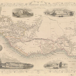
Western Africa
Permalink
https://digital.library.illinois.edu/items/218c2960-e946-0133-1d3d-0050569601ca-c
This item is in the public domain.
Descriptive Information
| Title | Western Africa |
| Creator | Tallis, John, 1817-1876 |
| Date | 1850-1859 |
| Dimensions | 25.5 x 36.3 cm |
| Cartographic Scale | 1:11,000,000 |
| Coverage-Spatial | Africa, West |
| Genre | Maps |
| Language | English |
| Source | Loose sheet |
| Physical Location | rbx |
| Map No. in Bassett and Scheven Bibliography | 2207 |
| Call Number | G8735/185-_R3 |
| Map ID | afm0002207 |
| Rights | No Copyright - United States |
| Rights Description | This item is in the public domain. |
| Collection Title | Maps of Africa to 1900 |
| Repository | Rare Book & Manuscript Library |
| Type | Cartographic material |
| Collection | Maps of Africa to 1900 |
Download Options
|
Western Africa |
Contact us
for questions and to provide feedback.