
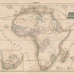
Africa
Permalink
https://digital.library.illinois.edu/items/21a527d0-e946-0133-1d3d-0050569601ca-7
This item is in the public domain.
Descriptive Information
| Title | Africa |
| Creator | Völter, Daniel, 1814-1865 |
| Date | 1842 |
| Dimensions | 25.3 x 32.1 cm |
| Place of Publication | Germany |
| Cartographic Scale | 1:34,200,000 |
| Coverage-Spatial | Africa |
| Genre | Maps |
| Color | Hand colored |
| Technique | Lithography |
| Source | Schul-Atlas, plate 31. |
| Physical Location | stx |
| Map No. in Bassett and Scheven Bibliography | 199 |
| Call Number | Q_912V88S |
| Map ID | afm0000199 |
| Rights | No Copyright - United States |
| Rights Description | This item is in the public domain. |
| Collection Title | Maps of Africa to 1900 |
| Repository | Rare Book & Manuscript Library |
| Type | Cartographic material |
| Collection | Maps of Africa to 1900 |
Download Options
Contact us
for questions and to provide feedback.