
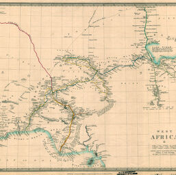
West Africa II
Permalink
https://digital.library.illinois.edu/items/21a89730-e946-0133-1d3d-0050569601ca-3
This item is in the public domain.
Descriptive Information
| Title | West Africa II |
| Creator | Society for the Diffusion of Useful Knowledge (Great Britain) |
| Date | 1839 |
| Dimensions | 31 x 39 cm |
| Place of Publication | England |
| Cartographic Scale | 1:5,500,000 |
| Notes | Relief shown by hachures and spot heights. |
| Coverage-Spatial | Africa, West |
| Subject | |
| Genre | Maps |
| Language | English |
| Color | Hand colored |
| Technique | Lithography |
| Source | Loose sheet |
| Physical Location | max |
| Map No. in Bassett and Scheven Bibliography | 2199 |
| Call Number | G87351839_W3 |
| Map ID | afm0002199 |
| Rights | No Copyright - United States |
| Rights Description | This item is in the public domain. |
| Collection Title | Maps of Africa to 1900 |
| Repository | Rare Book & Manuscript Library |
| Type | Cartographic material |
| Collection | Maps of Africa to 1900 |
Download Options
|
West Africa II |
Contact us
for questions and to provide feedback.