
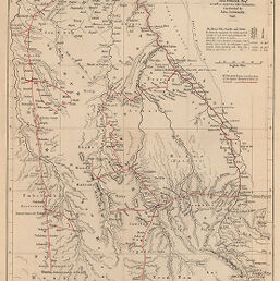
Nile and its Western Affluents, between the Albert Nyanza on the South, and the Sobat on the North
Permalink
https://digital.library.illinois.edu/items/21d2f230-e946-0133-1d3d-0050569601ca-1
This item is in the public domain.
Descriptive Information
| Title | Nile and its Western Affluents, between the Albert Nyanza on the South, and the Sobat on the North |
| Creator | Arrowsmith, John, 1790-1873 |
| Date | 1865 |
| Dimensions | 35.6 x 20.1 cm |
| Place of Publication | England |
| Cartographic Scale | 1:2,450,000 |
| Coverage-Spatial | Africa |
| Genre | Maps |
| Language | English |
| Source | Journal of the Royal Geographic Society, V. 35, between pp. 288-289. |
| Physical Location | rbx |
| Map No. in Bassett and Scheven Bibliography | 244 |
| Call Number | 910_6ROJ (Online resource, http://www_library_uiuc_edu/orr/results_php?resid=35994) |
| Map ID | afm0000244 |
| Rights | No Copyright - United States |
| Rights Description | This item is in the public domain. |
| Collection Title | Maps of Africa to 1900 |
| Repository | Rare Book & Manuscript Library |
| Type | Cartographic material |
| Collection | Maps of Africa to 1900 |
Download Options
|
Nile and its Western Affluents, between the Albert Nyanza on the South, and the Sobat on the North |
Contact us
for questions and to provide feedback.