


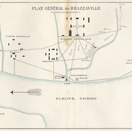
Plan Général de Brazzaville
Permalink
https://digital.library.illinois.edu/items/22191980-e946-0133-1d3d-0050569601ca-6
This item is in the public domain.
Descriptive Information
| Title | Plan Général de Brazzaville |
| Creator | le Parquier, M. |
| Date | 1898 |
| Dimensions | 20.7 x 26.7 cm |
| Cartographic Scale | Scale not given |
| Coverage-Spatial | Africa, French-speaking Equatorial |
| Subject | |
| Genre | Maps |
| Language | French |
| Color | Printed color |
| Technique | Lithography |
| Source | Bulletin de l'année, V. 20, between pp. 256-257. |
| Physical Location | stx |
| Map No. in Bassett and Scheven Bibliography | 2102 |
| Call Number | 910_6SOI |
| Map ID | afm0002102 |
| Rights | No Copyright - United States |
| Rights Description | This item is in the public domain. |
| Collection Title | Maps of Africa to 1900 |
| Repository | Rare Book & Manuscript Library |
| Type | Cartographic material |
| Collection | Maps of Africa to 1900 |
Download Options
|
Plan Général de Brazzaville |
Contact us
for questions and to provide feedback.