
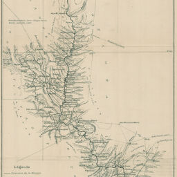
Vallée de la rivière Kota explorée par le Capne: Julien 1er. - 5 Octobre 1894
Permalink
https://digital.library.illinois.edu/items/222a4e40-e946-0133-1d3d-0050569601ca-a
This item is in the public domain.
Descriptive Information
| Title | Vallée de la rivière Kota explorée par le Capne: Julien 1er. - 5 Octobre 1894 |
| Date | 1897 |
| Dimensions | 48 x 24 cm |
| Cartographic Scale | 1:400,000 |
| Notes | Needs repair. |
| Coverage-Spatial | Africa, Central |
| Genre | Maps |
| Language | French |
| Color | Bitonal |
| Technique | Lithography |
| Source | Bulletin de la Société de géographie, ser. 7, V. 18, between pp. 256-257. |
| Physical Location | stx |
| Map No. in Bassett and Scheven Bibliography | 2099 |
| Call Number | 910_6SOGEASER_7 |
| Map ID | afm0002099 |
| Rights | No Copyright - United States |
| Rights Description | This item is in the public domain. |
| Collection Title | Maps of Africa to 1900 |
| Repository | Rare Book & Manuscript Library |
| Type | Cartographic material |
| Collection | Maps of Africa to 1900 |
Download Options
|
Vallée de la rivière Kota explorée par le Capne: Julien 1er. - 5 Octobre 1894 |
Contact us
for questions and to provide feedback.