
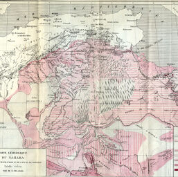
Carte Géologique du Sahara du Maroc à la Tripolitaine et de l'Atlas au Ahaggar
Permalink
https://digital.library.illinois.edu/items/224c7d10-e946-0133-1d3d-0050569601ca-6
This item is in the public domain.
Descriptive Information
| Title | Carte Géologique du Sahara du Maroc à la Tripolitaine et de l'Atlas au Ahaggar |
| Creator | Rolland, M. G. |
| Date | 1886 |
| Dimensions | 30 x 37.8 cm |
| Place of Publication | France |
| Cartographic Scale | 1:5,000,000 |
| Notes | Relief shown by hachures and spot heights. |
| Coverage-Spatial | Sahara |
| Subject | |
| Genre | Maps |
| Language | French |
| Color | Printed color |
| Technique | Lithography |
| Source | Bulletin de la Société de géographie, ser. 7, V. 7, between pp. 320-321. |
| Physical Location | stx |
| Map No. in Bassett and Scheven Bibliography | 350 |
| Call Number | 910_6SOGEASER_7 |
| Map ID | afm0000350 |
| Rights | No Copyright - United States |
| Rights Description | This item is in the public domain. |
| Collection Title | Maps of Africa to 1900 |
| Repository | Rare Book & Manuscript Library |
| Type | Cartographic material |
| Collection | Maps of Africa to 1900 |
Download Options
|
Carte Géologique du Sahara du Maroc à la Tripolitaine et de l'Atlas au Ahaggar |
Contact us
for questions and to provide feedback.