
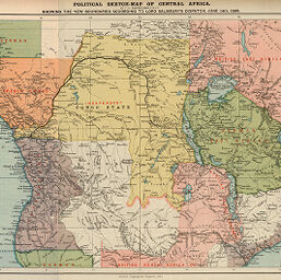
Political sketch-map of Central Africa
Permalink
https://digital.library.illinois.edu/items/22ad8770-e946-0133-1d3d-0050569601ca-4
This item is in the public domain.
Descriptive Information
| Title | Political sketch-map of Central Africa |
| Creator | Bartholomew, J. G. (John George), 1860-1920 |
| Date | 1890 |
| Dimensions | 25.1 x 38.1 cm |
| Cartographic Scale | 1:11,600,000 |
| Coverage-Spatial | Africa, Central |
| Genre | Maps |
| Language | English |
| Color | Printed color |
| Source | Scottish geographical magazine, V. 6, between pp. 376-377. |
| Physical Location | stx |
| Map No. in Bassett and Scheven Bibliography | 2025 |
| Call Number | 910_5SC |
| Map ID | afm0002025 |
| Rights | No Copyright - United States |
| Rights Description | This item is in the public domain. |
| Collection Title | Maps of Africa to 1900 |
| Repository | Rare Book & Manuscript Library |
| Type | Cartographic material |
| Collection | Maps of Africa to 1900 |
Download Options
|
Political sketch-map of Central Africa |
Contact us
for questions and to provide feedback.