


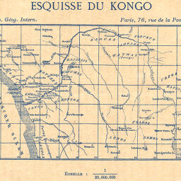
Esquisse du Kongo
Permalink
https://digital.library.illinois.edu/items/22e6b880-e946-0133-1d3d-0050569601ca-8
This item is in the public domain.
Descriptive Information
| Title | Esquisse du Kongo |
| Creator | Revue Géographique Internationale |
| Date | 1888 |
| Dimensions | 7.5 x 11.8 cm |
| Place of Publication | France |
| Cartographic Scale | 1:20,000,000 |
| Coverage-Spatial | Congo River Watershed |
| Subject | |
| Genre | Maps |
| Language | French |
| Color | Printed color |
| Technique | Lithography |
| Source | Revue géographique internationale, V. 13, between pp. 182-183. |
| Physical Location | stos |
| Map No. in Bassett and Scheven Bibliography | 1998 |
| Call Number | 910_5REGI |
| Map ID | afm0001998 |
| Rights | No Copyright - United States |
| Rights Description | This item is in the public domain. |
| Collection Title | Maps of Africa to 1900 |
| Repository | Rare Book & Manuscript Library |
| Type | Cartographic material |
| Collection | Maps of Africa to 1900 |
Download Options
|
Esquisse du Kongo |
Contact us
for questions and to provide feedback.