


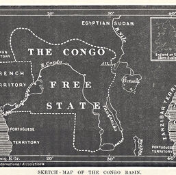
Sketch - Map of the Congo Basin
Permalink
https://digital.library.illinois.edu/items/23468c10-e946-0133-1d3d-0050569601ca-2
This item is in the public domain.
Descriptive Information
| Title | Sketch - Map of the Congo Basin |
| Creator | Manchester Geographical Society |
| Date | 1885 |
| Dimensions | 7.8 x 11.9 cm |
| Cartographic Scale | 1:37,000,000 |
| Notes | Includes inset map of England, on the same scale. |
| Coverage-Spatial | Africa, French-speaking Equatorial |
| Subject | |
| Genre | Maps |
| Language | English |
| Color | Bitonal |
| Technique | Lithography |
| Source | The Journal of the Manchester Geographical Society, V. 1, p. 27. |
| Physical Location | stx |
| Map No. in Bassett and Scheven Bibliography | 1946 |
| Call Number | 910_6MA |
| Map ID | afm0001946 |
| Rights | No Copyright - United States |
| Rights Description | This item is in the public domain. |
| Collection Title | Maps of Africa to 1900 |
| Repository | Rare Book & Manuscript Library |
| Type | Cartographic material |
| Collection | Maps of Africa to 1900 |
Download Options
|
Sketch - Map of the Congo Basin |
Contact us
for questions and to provide feedback.