
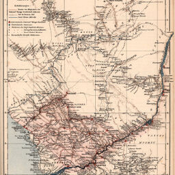
Das Gebiet der Internationalen Kongo-Gesellschaft, nach R. de Lannoy de Bissy, Chavanne u.. A
Permalink
https://digital.library.illinois.edu/items/2349dbc0-e946-0133-1d3d-0050569601ca-d
This item is in the public domain.
Descriptive Information
| Title | Das Gebiet der Internationalen Kongo-Gesellschaft, nach R. de Lannoy de Bissy, Chavanne u.. A |
| Creator | Lannoy de Bissy, Régnauld de |
| Date | 1884 |
| Dimensions | 25 x 20 cm |
| Cartographic Scale | 1:3,000,000 |
| Notes | Printed and hand colored. |
| Coverage-Spatial | Africa, Central |
| Genre | Maps |
| Language | German |
| Color | Printed color |
| Technique | Lithography |
| Source | Petermanns geographische Mitteilungen, V. 30, plate 12. |
| Physical Location | stx |
| Map No. in Bassett and Scheven Bibliography | 1934 |
| Call Number | Q_910_5PE |
| Map ID | afm0001934 |
| Rights | No Copyright - United States |
| Rights Description | This item is in the public domain. |
| Collection Title | Maps of Africa to 1900 |
| Repository | Rare Book & Manuscript Library |
| Type | Cartographic material |
| Collection | Maps of Africa to 1900 |
Download Options
|
Das Gebiet der Internationalen Kongo-Gesellschaft, nach R. de Lannoy de Bissy, Chavanne u.. A |
Contact us
for questions and to provide feedback.