
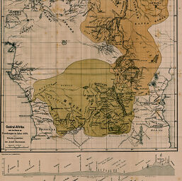
Central-Afrika nach dem Stande der Forschungen im Jahre 1876
Permalink
https://digital.library.illinois.edu/items/23c429f0-e946-0133-1d3d-0050569601ca-c
This item is in the public domain.
Descriptive Information
| Title | Central-Afrika nach dem Stande der Forschungen im Jahre 1876 |
| Creator | Chavanne, Josef, 1846-1902 |
| Date | 1876 |
| Dimensions | 37 x 39.6 cm |
| Cartographic Scale | 1:9,300,000 |
| Notes | Relief shown by hachures. Includes two elevation profiles in lower margin. |
| Coverage-Spatial | Africa, Central |
| Subject | |
| Genre | Maps |
| Language | German |
| Color | Printed color |
| Technique | Lithography |
| Source | Mitteilungen der Österreichischen Geographischen Gesellschaft, V. 19, after p. 664. |
| Physical Location | stx |
| Map No. in Bassett and Scheven Bibliography | 1873 |
| Call Number | 910_5GEOW |
| Map ID | afm0001873 |
| Rights | No Copyright - United States |
| Rights Description | This item is in the public domain. |
| Collection Title | Maps of Africa to 1900 |
| Repository | Rare Book & Manuscript Library |
| Type | Cartographic material |
| Collection | Maps of Africa to 1900 |
Download Options
|
Central-Afrika nach dem Stande der Forschungen im Jahre 1876 |
Contact us
for questions and to provide feedback.