
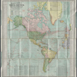
Scarborough's map of the world
Permalink
https://digital.library.illinois.edu/items/24295010-4e08-013e-321b-02d0d7bfd6e4-3
This item is in the public domain.
Descriptive Information
| Title | Scarborough's map of the world |
| Alternative Title |
|
| Creator | Scarborough Company |
| Scale | Scale approximately 1:26,000,000. At equator |
| Coordinates | W 180°--E 180°/N 82°--S 63° |
| Place of Publication | London (England) |
| Publisher | Scarborough Company |
| Date of Publication | 1907 |
| Extent | 2 maps on 1 sheet : both sides, color |
| Dimensions | 99 x 93 cm and 99 x 86 cm, on sheet 106 x 101 cm, folded in case 27 x 14 x 1.6 cm |
| Notes |
|
| Language | English |
| Genre | Maps |
| Rights | No Copyright - United States |
| Rights Description | This item is in the public domain. |
| Type | Cartographic material |
| Repository | Map Library |
| Local Bib ID | 99954878406805899 |
| Collection Title | American Empire Maps |
| Collection | American Empire Maps |
Download Options

|
99954878406805899-00000001 | |
|
99954878406805899-00000002 | |

|
99954878406805899-00000003 |
Contact us
for questions and to provide feedback.