
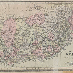
Southern Africa comprising Cape Colony, Natal, etc. With Orange Free State
Permalink
https://digital.library.illinois.edu/items/24584370-e946-0133-1d3d-0050569601ca-b
This item is in the public domain.
Descriptive Information
| Title | Southern Africa comprising Cape Colony, Natal, etc. With Orange Free State |
| Creator | Bradley, William M. and Brother |
| Date | 1894 |
| Dimensions | 21 x 32 cm |
| Place of Publication | United States |
| Cartographic Scale | 1:4,700,000 |
| Notes | On same page as ID Nos. 976, 977. |
| Coverage-Spatial | Africa, Southern |
| Genre | Maps |
| Language | English |
| Color | Hand colored |
| Technique | Lithography |
| Source | Potter-Bradley Atlas of the World, plate 28. |
| Physical Location | stx |
| Map No. in Bassett and Scheven Bibliography | 1778 |
| Call Number | F_912P85P |
| Map ID | afm0001778 |
| Rights | No Copyright - United States |
| Rights Description | This item is in the public domain. |
| Collection Title | Maps of Africa to 1900 |
| Repository | Rare Book & Manuscript Library |
| Type | Cartographic material |
| Collection | Maps of Africa to 1900 |
Download Options
|
Southern Africa comprising Cape Colony, Natal, etc. With Orange Free State |
Contact us
for questions and to provide feedback.