
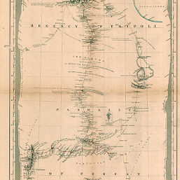
Map of part of Northern Africa showing the Routes of the Expedition under Messrs. Richardson, Barth, Overweg & Vogel in the years 1850 and 1853
Permalink
https://digital.library.illinois.edu/items/246019e0-e946-0133-1d3d-0050569601ca-a
This item is in the public domain.
Descriptive Information
| Title | Map of part of Northern Africa showing the Routes of the Expedition under Messrs. Richardson, Barth, Overweg & Vogel in the years 1850 and 1853 |
| Creator | Petermann, A. (August), 1822-1878 |
| Date | 1855 |
| Dimensions | 50.7 x 35.3 cm |
| Place of Publication | Germany |
| Cartographic Scale | 1:2,125,000 |
| Notes | Relief shown by hachures, contours and spot heights. Includes elevation profiles inside right, left and bottom neatlines. |
| Coverage-Spatial | Tripolitania |
| Subject | |
| Genre | Maps |
| Language | English |
| Color | Hand colored |
| Technique | Lithography |
| Source | Petermanns geographische Mitteilungen, V. 1, plate 19. |
| Physical Location | stx |
| Map No. in Bassett and Scheven Bibliography | 708 |
| Call Number | Q_910_5PE |
| Map ID | afm0000708 |
| Rights | No Copyright - United States |
| Rights Description | This item is in the public domain. |
| Collection Title | Maps of Africa to 1900 |
| Repository | Rare Book & Manuscript Library |
| Type | Cartographic material |
| Collection | Maps of Africa to 1900 |
Download Options
|
Map of part of Northern Africa showing the Routes of the Expedition under Messrs. Richardson, Barth, Overweg & Vogel in the years 1850 and 1853 |
Contact us
for questions and to provide feedback.