
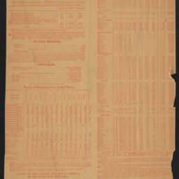
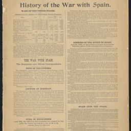
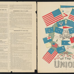
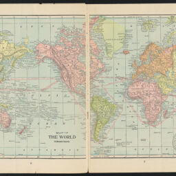
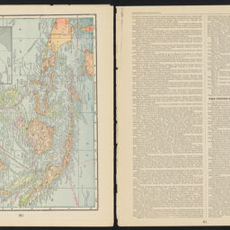
The Inter Ocean war atlas : showing all fighting territory, contains 16 pages of maps covering all territory where a conflict could occur between the naval or land forces of the United States and Spain, and 6 pages of valuable statistics showing financial, military and naval strength of the two nations, together with brief history of Cuba
Permalink
https://digital.library.illinois.edu/items/2475e960-4e08-013e-321b-02d0d7bfd6e4-6
This item is in the public domain.
Descriptive Information
| Title | The Inter Ocean war atlas : showing all fighting territory, contains 16 pages of maps covering all territory where a conflict could occur between the naval or land forces of the United States and Spain, and 6 pages of valuable statistics showing financial, military and naval strength of the two nations, together with brief history of Cuba |
| Creator | Cram, George Franklin, 1841-1928 |
| Contributor | Inter Ocean Newspaper Company |
| Scale | Scales differ |
| Place of Publication | Chicago (Ill.) |
| Publisher | Inter Ocean Newspaper Company |
| Date of Publication | 1898-09 |
| Extent | 23 pages : maps (some color) |
| Dimensions | 35 cm |
| Notes |
|
| Language | English |
| Genre | Maps |
| Rights | No Copyright - United States |
| Rights Description | This item is in the public domain. |
| Type | Cartographic material |
| Repository | Map Library |
| Local Bib ID | 99955492792105899 |
| Collection Title | American Empire Maps |
| Collection | American Empire Maps |
Download Options

|
99955492792105899-00000001 | |
|
99955492792105899-00000002 | |
|
99955492792105899-00000003 | |
|
99955492792105899-00000004 | |
|
99955492792105899-00000005 | |
|
99955492792105899-00000006 | |
|
99955492792105899-00000007 | |

|
99955492792105899-00000008 | |
|
99955492792105899-00000009 | |
|
99955492792105899-00000010 | |

|
99955492792105899-00000011 | |
|
99955492792105899-00000012 | |
|
99955492792105899-00000013 |
Contact us
for questions and to provide feedback.