
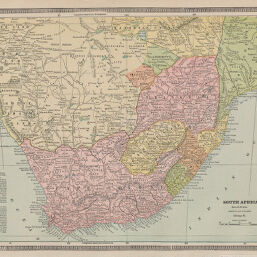
South Africa
Permalink
https://digital.library.illinois.edu/items/24e3c310-e946-0133-1d3d-0050569601ca-b
This item is in the public domain.
Descriptive Information
| Title | South Africa |
| Creator | Cram, George Franklin, 1841-1928 |
| Date | 1885 |
| Dimensions | 24.5 x 32 cm |
| Place of Publication | United States |
| Cartographic Scale | 1:7,700,000 |
| Notes | Slight damage on lower part of map, top surface torn away in small patches. |
| Coverage-Spatial | Africa, Southern |
| Genre | Maps |
| Color | Printed color |
| Technique | Lithography |
| Source | Unrivaled Family Atlas, p. 116. |
| Physical Location | stx |
| Map No. in Bassett and Scheven Bibliography | 1713 |
| Call Number | Q_912C84U1885 |
| Map ID | afm0001713 |
| Rights | No Copyright - United States |
| Rights Description | This item is in the public domain. |
| Collection Title | Maps of Africa to 1900 |
| Repository | Rare Book & Manuscript Library |
| Type | Cartographic material |
| Collection | Maps of Africa to 1900 |
Download Options
|
South Africa |
Contact us
for questions and to provide feedback.