
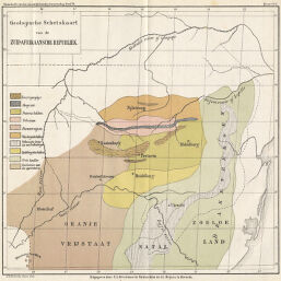
Geologische Schetskaart van de Zuid-Afrikaansche Republiek
Permalink
https://digital.library.illinois.edu/items/250a9b80-e946-0133-1d3d-0050569601ca-3
This item is in the public domain.
Descriptive Information
| Title | Geologische Schetskaart van de Zuid-Afrikaansche Republiek |
| Creator | Beijers, J.L. |
| Date | 1882 |
| Dimensions | 25 x 25.9 cm |
| Place of Publication | Netherlands |
| Cartographic Scale | 1:3,600,000 |
| Coverage-Spatial | South Africa |
| Subject | |
| Genre | Maps |
| Language | Dutch |
| Color | Printed color |
| Technique | Lithography |
| Source | Tijdschrift. Bijbladen, V. 6, between pp. 98-99. |
| Physical Location | stx |
| Map No. in Bassett and Scheven Bibliography | 1698 |
| Call Number | 910_6NE |
| Map ID | afm0001698 |
| Rights | No Copyright - United States |
| Rights Description | This item is in the public domain. |
| Collection Title | Maps of Africa to 1900 |
| Repository | Rare Book & Manuscript Library |
| Type | Cartographic material |
| Collection | Maps of Africa to 1900 |
Download Options
|
Geologische Schetskaart van de Zuid-Afrikaansche Republiek |
Contact us
for questions and to provide feedback.