
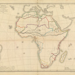
Afrique pour la Géographie de M. M. Achille Meissas et A. Michelot, dressée par Charle, Geographe, attaché au Dépôt général de la guerre, 1833
Permalink
https://digital.library.illinois.edu/items/254455b0-e946-0133-1d3d-0050569601ca-a
This item is in the public domain.
Descriptive Information
| Title | Afrique pour la Géographie de M. M. Achille Meissas et A. Michelot, dressée par Charle, Geographe, attaché au Dépôt général de la guerre, 1833 |
| Creator | Meissas, Achille, 1799-1874 |
| Date | 1833 |
| Dimensions | 39 x 48 cm |
| Place of Publication | Paris (France) |
| Cartographic Scale | 1:25,000,000 |
| Coverage-Spatial | Africa |
| Genre | Maps |
| Language | French |
| Physical Location | Professor Thomas Bassett Personal Collection |
| Map ID | afm0003101 |
| Rights | No Copyright - United States |
| Rights Description | This item is in the public domain. |
| Collection Title | Maps of Africa to 1900 |
| Repository | Rare Book & Manuscript Library |
| Type | Cartographic material |
| Collection | Maps of Africa to 1900 |
Download Options
|
Afrique pour la Géographie de M. M. Achille Meissas et A. Michelot, dressée par Charle, Geographe, attaché au Dépôt général de la guerre, 1833 |
Contact us
for questions and to provide feedback.