
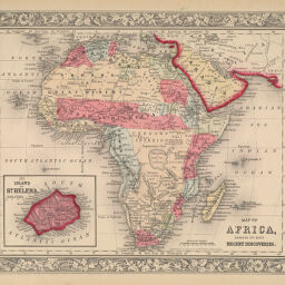
Map of Africa Showing its Most Recent Discoveries.
Permalink
https://digital.library.illinois.edu/items/25532030-e946-0133-1d3d-0050569601ca-0
This item is in the public domain.
Descriptive Information
| Title | Map of Africa Showing its Most Recent Discoveries. |
| Creator | Mitchell, S. Augustus (Samuel Augustus), 1792-1868 |
| Date | 1862 |
| Dimensions | 27 x 33.5 cm |
| Place of Publication | Philadelphia (Pa.) |
| Cartographic Scale | 1:37,000,000 |
| Notes | Inset of St. Helena Island. |
| Coverage-Spatial | Africa |
| Genre | Maps |
| Language | English |
| Source | Mitchell's New General Atlas, Philadelphia, 1862. |
| Physical Location | Professor Thomas Bassett Personal Collection |
| Bibliography | Norwich Map 146 |
| Map ID | afm0003079 |
| Rights | No Copyright - United States |
| Rights Description | This item is in the public domain. |
| Collection Title | Maps of Africa to 1900 |
| Repository | Rare Book & Manuscript Library |
| Type | Cartographic material |
| Collection | Maps of Africa to 1900 |
Download Options
|
Map of Africa Showing its Most Recent Discoveries. |
Contact us
for questions and to provide feedback.