


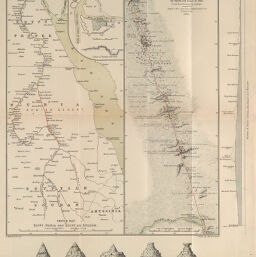
Sketch Map of Egypt, Nubia and Egyptian Sudan
Permalink
https://digital.library.illinois.edu/items/25714060-e946-0133-1d3d-0050569601ca-d
This item is in the public domain.
Descriptive Information
| Title | Sketch Map of Egypt, Nubia and Egyptian Sudan |
| Creator | Sharbau, H. (Henry) |
| Date | 1884 |
| Dimensions | 34.2 x 16.2 cm |
| Place of Publication | England |
| Cartographic Scale | 1:3,100,000 |
| Coverage-Spatial | Africa, North |
| Genre | Maps |
| Language | English |
| Source | Proceedings of the Royal Geographical Society, V. 6, No. 6, after p. 364. |
| Physical Location | rbx |
| Map No. in Bassett and Scheven Bibliography | 869 |
| Call Number | 910_6RLn_s_ |
| Map ID | afm0000869 |
| Rights | No Copyright - United States |
| Rights Description | This item is in the public domain. |
| Collection Title | Maps of Africa to 1900 |
| Repository | Rare Book & Manuscript Library |
| Type | Cartographic material |
| Collection | Maps of Africa to 1900 |
Download Options
|
Sketch Map of Egypt, Nubia and Egyptian Sudan |
Contact us
for questions and to provide feedback.