
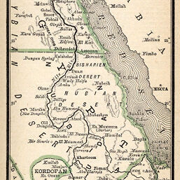
Egypt, Nubia & Abyssinia
Permalink
https://digital.library.illinois.edu/items/25dd33d0-e946-0133-1d3d-0050569601ca-2
This item is in the public domain.
Descriptive Information
| Title | Egypt, Nubia & Abyssinia |
| Creator | Rand McNally and Company |
| Date | 1887 |
| Dimensions | 13 x 7.2 cm |
| Place of Publication | United States |
| Cartographic Scale | 1:20,500,000 |
| Notes | Relief shown by hachures. |
| Coverage-Spatial | Nile River |
| Subject | |
| Genre | Maps |
| Language | English |
| Color | Printed color |
| Technique | Lithography |
| Source | Rand, McNally & Co.'s pocket atlas of the world, p. 51. |
| Physical Location |
|
| Map No. in Bassett and Scheven Bibliography | 899 |
| Call Number | 912R15P1887 |
| Map ID | afm0000899 |
| Rights | No Copyright - United States |
| Rights Description | This item is in the public domain. |
| Collection Title | Maps of Africa to 1900 |
| Repository | Rare Book & Manuscript Library |
| Type | Cartographic material |
| Collection | Maps of Africa to 1900 |
Download Options
|
Egypt, Nubia & Abyssinia |
Contact us
for questions and to provide feedback.