
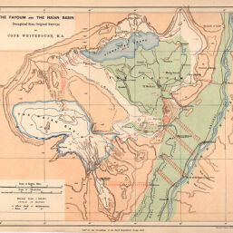
Fayoum and the Raan Basin, Draughted from Original Surveys: Egypt
Permalink
https://digital.library.illinois.edu/items/25e987c0-e946-0133-1d3d-0050569601ca-d
This item is in the public domain.
Descriptive Information
| Title | Fayoum and the Raan Basin, Draughted from Original Surveys: Egypt |
| Creator | Whitehouse, Frederic Cope, 1842-1911 |
| Date | 1887 |
| Dimensions | 22.2 x 26 cm |
| Place of Publication | England |
| Cartographic Scale | 1:500,000 |
| Coverage-Spatial | Africa, North |
| Genre | Maps |
| Language | English |
| Source | Proceedings of the Royal Geographical Society, V. 9, No. 10, after p. 658. |
| Physical Location | rbx |
| Map No. in Bassett and Scheven Bibliography | 904 |
| Call Number | 910_6RLn_s_ |
| Map ID | afm0000904 |
| Rights | No Copyright - United States |
| Rights Description | This item is in the public domain. |
| Collection Title | Maps of Africa to 1900 |
| Repository | Rare Book & Manuscript Library |
| Type | Cartographic material |
| Collection | Maps of Africa to 1900 |
Download Options
|
Fayoum and the Raan Basin, Draughted from Original Surveys: Egypt |
Contact us
for questions and to provide feedback.