
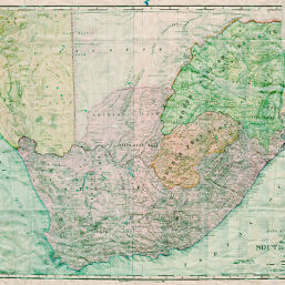
Rand, McNally & Co.'s Indexed Atlas of the World Map of South Africa
Permalink
https://digital.library.illinois.edu/items/263ad290-e946-0133-1d3d-0050569601ca-c
This item is in the public domain.
Descriptive Information
| Title | Rand, McNally & Co.'s Indexed Atlas of the World Map of South Africa |
| Creator | Rand McNally and Company |
| Date | 1899 |
| Dimensions | 48 x 65.5 cm |
| Place of Publication | United States |
| Cartographic Scale | 1:3,120,000 |
| Notes | Relief shown by hachures. |
| Coverage-Spatial | Swaziland |
| Subject | |
| Genre | Maps |
| Language | English |
| Color | Printed color |
| Technique | Lithography |
| Source | Loose sheet |
| Physical Location | max |
| Map No. in Bassett and Scheven Bibliography | 1808 |
| Call Number | G8580_R3 |
| Map ID | afm0001808 |
| Rights | No Copyright - United States |
| Rights Description | This item is in the public domain. |
| Collection Title | Maps of Africa to 1900 |
| Repository | Rare Book & Manuscript Library |
| Type | Cartographic material |
| Collection | Maps of Africa to 1900 |
Download Options
|
Rand, McNally & Co.'s Indexed Atlas of the World Map of South Africa |
Contact us
for questions and to provide feedback.