
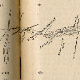
[Route from Tananarivo to to Andevoranto, Madagascar]
Permalink
https://digital.library.illinois.edu/items/267dda20-e946-0133-1d3d-0050569601ca-8
This item is in the public domain.
Descriptive Information
| Title | [Route from Tananarivo to to Andevoranto, Madagascar] |
| Creator | Revue Géographique Internationale |
| Date | 1890 |
| Dimensions | 33.5 x 4.8 cm |
| Place of Publication | France |
| Cartographic Scale | 1:600,000 |
| Notes | Title supplied by cataloger. Relief shown by spot heights. Paris and Ferro Island meridians. |
| Coverage-Spatial | Madagascar |
| Subject | Routes |
| Genre | Maps |
| Language | English |
| Color | Bitonal |
| Technique | Lithography |
| Source | Revue géographique internationale, V. 15, pp. 12-13. |
| Physical Location | stos |
| Map No. in Bassett and Scheven Bibliography | 1358 |
| Call Number | 910_5REGI |
| Map ID | afm0001358 |
| Rights | No Copyright - United States |
| Rights Description | This item is in the public domain. |
| Collection Title | Maps of Africa to 1900 |
| Repository | Rare Book & Manuscript Library |
| Type | Cartographic material |
| Collection | Maps of Africa to 1900 |
Download Options
|
[Route from Tananarivo to to Andevoranto, Madagascar] |
Contact us
for questions and to provide feedback.