
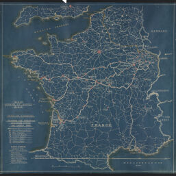
Map of France, showing the American activities during the World War
Permalink
https://digital.library.illinois.edu/items/26e68940-6576-0138-727b-02d0d7bfd6e4-2
No Copyright - United States
Descriptive Information
| Title | Map of France, showing the American activities during the World War |
| Creator | Baldwin, Bert L. |
| Scale | Scale approximately 1:1,260,000 |
| Publisher | United States. Army. Services of Supply |
| Date of Publication | 1918 |
| Extent | 1 map |
| Dimensions | 80.6 x 82.9 cm |
| Notes |
|
| Coverage-Spatial | France |
| Language | English |
| Subject | |
| Genre | Thematic maps |
| Rights Description | No Copyright - United States |
| Type | Cartographic material |
| Repository | Map Library |
| Local Bib ID | 9362323 |
| Collection Title | World War I Maps |
| Collection | World War I Maps |
Download Options
|
Map of France, showing the American activities during the World War |
Contact us
for questions and to provide feedback.