
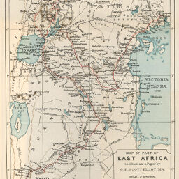
Map of part of East Africa
Permalink
https://digital.library.illinois.edu/items/271a2c90-e946-0133-1d3d-0050569601ca-2
This item is in the public domain.
Descriptive Information
| Title | Map of part of East Africa |
| Creator | Elliot, G. F. Scott (George Francis Scott), 1862-1934 |
| Date | 1895 |
| Dimensions | 24.8 x 20 cm |
| Place of Publication | England |
| Cartographic Scale | 1:2,000,000 |
| Notes | Some printed color is aquatint. |
| Coverage-Spatial | Africa, Eastern |
| Genre | Maps |
| Language | English |
| Color | Printed color |
| Technique | Lithography |
| Source | The Geographical Journal, V. 6, between pp. 400-401. |
| Physical Location | stx |
| Map No. in Bassett and Scheven Bibliography | 1482 |
| Call Number | 910_5GJ |
| Map ID | afm0001482 |
| Rights | No Copyright - United States |
| Rights Description | This item is in the public domain. |
| Collection Title | Maps of Africa to 1900 |
| Repository | Rare Book & Manuscript Library |
| Type | Cartographic material |
| Collection | Maps of Africa to 1900 |
Download Options
|
Map of part of East Africa |
Contact us
for questions and to provide feedback.