
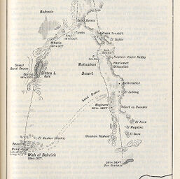
Map of Siwa
Permalink
https://digital.library.illinois.edu/items/273616d0-e946-0133-1d3d-0050569601ca-3
This item is in the public domain.
Descriptive Information
| Title | Map of Siwa |
| Creator | Walker & Boutall |
| Date | 1897 |
| Dimensions | 11.5 x 19.2 cm |
| Place of Publication | England |
| Cartographic Scale | Scale not given |
| Notes | Relief shown by hachures. |
| Coverage-Spatial | Sīwah (Egypt) |
| Subject | |
| Genre | Maps |
| Language | English |
| Color | Bitonal |
| Technique | Other |
| Source | The Geographical Journal, V. 10, p. 601. |
| Physical Location | stx |
| Map No. in Bassett and Scheven Bibliography | 999 |
| Call Number | 910_5GJ |
| Map ID | afm0000999 |
| Rights | No Copyright - United States |
| Rights Description | This item is in the public domain. |
| Collection Title | Maps of Africa to 1900 |
| Repository | Rare Book & Manuscript Library |
| Type | Cartographic material |
| Collection | Maps of Africa to 1900 |
Download Options
|
Map of Siwa |
Contact us
for questions and to provide feedback.