
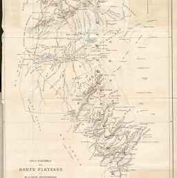
Carte d’ensemble des Hauts Plateaux et de la Partie septentrionale de Sahara de la Subdivision de Tlemcen.
Permalink
https://digital.library.illinois.edu/items/27466870-e946-0133-1d3d-0050569601ca-e
This item is in the public domain.
Descriptive Information
| Title | Carte d’ensemble des Hauts Plateaux et de la Partie septentrionale de Sahara de la Subdivision de Tlemcen. |
| Creator | Dastugue, (General) |
| Date | 1874 |
| Dimensions | 39.7 x 28.5 cm |
| Place of Publication | France |
| Cartographic Scale | 1:800,000 |
| Coverage-Spatial | Africa, North |
| Genre | Maps |
| Language | French |
| Technique | Lithography |
| Source | Bulletin de la Société de géographie. V.7, after p. 38. |
| Physical Location | stx |
| Map No. in Bassett and Scheven Bibliography | 783 |
| Call Number | 910_6SOGEASER_6 |
| Map ID | afm0000783 |
| Rights | No Copyright - United States |
| Rights Description | This item is in the public domain. |
| Collection Title | Maps of Africa to 1900 |
| Repository | Rare Book & Manuscript Library |
| Type | Cartographic material |
| Collection | Maps of Africa to 1900 |
Download Options
|
Carte d’ensemble des Hauts Plateaux et de la Partie septentrionale de Sahara de la Subdivision de Tlemcen. |
Contact us
for questions and to provide feedback.