


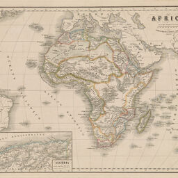
Africa
Permalink
https://digital.library.illinois.edu/items/27e5b3d0-e946-0133-1d3d-0050569601ca-6
This item is in the public domain.
Descriptive Information
| Title | Africa |
| Creator | Arrigoni, Ferdinando |
| Date | 1840-1849 |
| Dimensions | 30 x 38.5 cm |
| Place of Publication | Italy |
| Cartographic Scale | 1:38,000,000 |
| Notes | In F, not Q, stacks. |
| Coverage-Spatial | Africa |
| Genre | Maps |
| Color | Hand colored |
| Technique | Etched or engraved |
| Source | Grande atlante di geografia universalestatistico e pittoresco, ad uso delle scuole e famiglie italiane, plate 6. |
| Physical Location | stx |
| Map No. in Bassett and Scheven Bibliography | 194 |
| Call Number | F_910M345G |
| Map ID | afm0000194 |
| Rights | No Copyright - United States |
| Rights Description | This item is in the public domain. |
| Collection Title | Maps of Africa to 1900 |
| Repository | Rare Book & Manuscript Library |
| Type | Cartographic material |
| Collection | Maps of Africa to 1900 |
Download Options
Contact us
for questions and to provide feedback.