
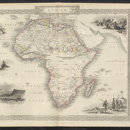
Africa
Permalink
https://digital.library.illinois.edu/items/283dde20-e946-0133-1d3d-0050569601ca-f
This item is in the public domain.
Descriptive Information
| Title | Africa |
| Creator | Tallis, J. & F. |
| Date | 1850 |
| Dimensions | 25 x 32.3 cm |
| Cartographic Scale | 1:43,000,000 |
| Coverage-Spatial | Africa |
| Genre | Maps |
| Source | The Illustrated Atlas, J & F Tallis, Edinburgh and Dublin |
| Physical Location | Professor Thomas Bassett Personal Collection |
| Bibliography |
|
| Map ID | afm0003247 |
| Rights | No Copyright - United States |
| Rights Description | This item is in the public domain. |
| Collection Title | Maps of Africa to 1900 |
| Repository | Rare Book & Manuscript Library |
| Type | Cartographic material |
| Collection | Maps of Africa to 1900 |
Download Options
Contact us
for questions and to provide feedback.