
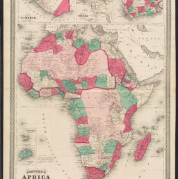
Johnson's Africa
Permalink
https://digital.library.illinois.edu/items/285d9330-e946-0133-1d3d-0050569601ca-7
This item is in the public domain.
Descriptive Information
| Title | Johnson's Africa |
| Date | 1864 |
| Dimensions | 58.5 x 43 cm |
| Place of Publication | New York (N.Y.) |
| Cartographic Scale | 1:20,000,000 |
| Notes | Inset maps of Cape Colony, Delta of the Nile, Liberia, Cape Verde Islands, and St. Helena. |
| Coverage-Spatial | Africa |
| Genre | Maps |
| Language | English |
| Source | Johnson's New Illustrated Family Atlas Of The World. New York, 1870, pp. 116-117. |
| Physical Location | Professor Thomas Bassett Personal Collection |
| Bibliography | Rumsey Collection No. 0358.069 |
| Map ID | afm0003240 |
| Rights | No Copyright - United States |
| Rights Description | This item is in the public domain. |
| Collection Title | Maps of Africa to 1900 |
| Repository | Rare Book & Manuscript Library |
| Type | Cartographic material |
| Collection | Maps of Africa to 1900 |
Download Options
|
Johnson's Africa |
Contact us
for questions and to provide feedback.