
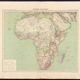
Afrique Politique
Permalink
https://digital.library.illinois.edu/items/28700740-e946-0133-1d3d-0050569601ca-0
This item is in the public domain.
Descriptive Information
| Title | Afrique Politique |
| Creator | Dumas-Vorzet, Ed. (Eduard) |
| Date | 1897 |
| Dimensions | 43.7 x 54 cm |
| Cartographic Scale | 1:20,000,000 |
| Coverage-Spatial | Africa |
| Genre | Maps |
| Language | French |
| Source | Atlas Universel de Géographie par Vivien de Saint Martin & Fr. Schrader, Publié par La Librairie Hachette & Cie |
| Physical Location | Professor Thomas Bassett Personal Collection |
| Bibliography | Listed in Phillips and Le Gear, v. 1, pp. 518-519, No. 57 |
| Map ID | afm0003228 |
| Rights | No Copyright - United States |
| Rights Description | This item is in the public domain. |
| Collection Title | Maps of Africa to 1900 |
| Repository | Rare Book & Manuscript Library |
| Type | Cartographic material |
| Collection | Maps of Africa to 1900 |
Download Options
|
Afrique Politique |
Contact us
for questions and to provide feedback.