
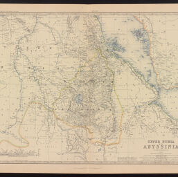
Upper Nubia and Abyssinia
Permalink
https://digital.library.illinois.edu/items/28742f30-e946-0133-1d3d-0050569601ca-6
This item is in the public domain.
Descriptive Information
| Title | Upper Nubia and Abyssinia |
| Creator | Johnston, Keith, 1844-1879 |
| Date | 1879 |
| Dimensions | 44.3 x 57.3 cm |
| Place of Publication | Edinburgh (Scotland) |
| Cartographic Scale | 1:2,854,868 |
| Coverage-Spatial | Africa |
| Genre | Maps |
| Language | English |
| Source | The Royal Atlas Of Modern Geography Exhibiting, In A Series Of Entirely Original And Authentic Maps, The Present Condition Of Geographical Discovery And Research In The Several Countries, Empires, And States Of The World By Alexander Keith Johnston. |
| Physical Location | Professor Thomas Bassett Personal Collection |
| Bibliography | Rumsey Collection No. 373.045 |
| Map ID | afm0003230 |
| Rights | No Copyright - United States |
| Rights Description | This item is in the public domain. |
| Collection Title | Maps of Africa to 1900 |
| Repository | Rare Book & Manuscript Library |
| Type | Cartographic material |
| Collection | Maps of Africa to 1900 |
Download Options
|
Upper Nubia and Abyssinia |
Contact us
for questions and to provide feedback.