
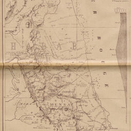
Le Pays des Haba (Abyssinie)
Permalink
https://digital.library.illinois.edu/items/28dc16f0-e946-0133-1d3d-0050569601ca-7
This item is in the public domain.
Descriptive Information
| Title | Le Pays des Haba (Abyssinie) |
| Creator | Habenicht, Hermann, 1844-1917 |
| Date | 1889 |
| Dimensions | 38.8 x 23.9 cm |
| Place of Publication | France |
| Cartographic Scale | 1:930,000 |
| Notes | Relief shown by shading and spot heights. Includes 2 inset elevation profiles. |
| Coverage-Spatial | Ethiopia |
| Subject | |
| Genre | Maps |
| Language | French |
| Color | Printed color |
| Technique | Lithography |
| Source | Revue géographique internationale, V. 14, between pp. 268-269. |
| Physical Location | stos |
| Map No. in Bassett and Scheven Bibliography | 1334 |
| Call Number | 910_5REGI |
| Map ID | afm0001334 |
| Rights | No Copyright - United States |
| Rights Description | This item is in the public domain. |
| Collection Title | Maps of Africa to 1900 |
| Repository | Rare Book & Manuscript Library |
| Type | Cartographic material |
| Collection | Maps of Africa to 1900 |
Download Options
|
Le Pays des Haba (Abyssinie) |
Contact us
for questions and to provide feedback.