
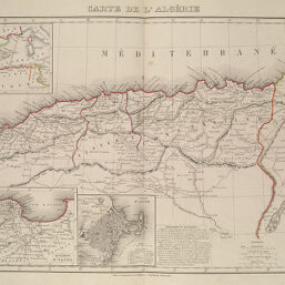
Carte de l'Algérie
Permalink
https://digital.library.illinois.edu/items/295bb7d0-e946-0133-1d3d-0050569601ca-5
This item is in the public domain.
Descriptive Information
| Title | Carte de l'Algérie |
| Creator | Vuillemin, A. (Alexandre), 1812- |
| Date | 1845 |
| Dimensions | 28 x 42 cm |
| Place of Publication | Paris (France) |
| Cartographic Scale | 1:2,700,000 |
| Notes |
|
| Coverage-Spatial | Africa, North |
| Genre | Maps |
| Language | French |
| Source | Atlas de Géographie Ancienne et Moderne à l'usage des Collèges et Maisons d'Education, Paris: Robiquet. |
| Physical Location | Professor Thomas Bassett Personal Collection |
| Map ID | afm0003166 |
| Rights | No Copyright - United States |
| Rights Description | This item is in the public domain. |
| Collection Title | Maps of Africa to 1900 |
| Repository | Rare Book & Manuscript Library |
| Type | Cartographic material |
| Collection | Maps of Africa to 1900 |
Download Options
|
Carte de l'Algérie |
Contact us
for questions and to provide feedback.