
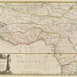
Carte de Nigritie et Guinee par P. Du Val d'Abbeville, Géographe du Roy…
Permalink
https://digital.library.illinois.edu/items/297ca4c0-e946-0133-1d3d-0050569601ca-9
This item is in the public domain.
Descriptive Information
| Title | Carte de Nigritie et Guinee par P. Du Val d'Abbeville, Géographe du Roy… |
| Creator | Duval, P. (Pierre), 1619-1682 |
| Date | 1653 |
| Dimensions | 39.5 x 54.5 |
| Place of Publication | Paris (France) |
| Cartographic Scale | 1:10,250,000 |
| Coverage-Spatial | Africa, West |
| Genre | Maps |
| Language | French |
| Source | Chez Pierre Mariette, Paris. |
| Physical Location | Professor Thomas Bassett Personal Collection |
| Map ID | afm0003150 |
| Rights | No Copyright - United States |
| Rights Description | This item is in the public domain. |
| Collection Title | Maps of Africa to 1900 |
| Repository | Rare Book & Manuscript Library |
| Type | Cartographic material |
| Collection | Maps of Africa to 1900 |
Download Options
|
Carte de Nigritie et Guinee par P. Du Val d'Abbeville, Géographe du Roy… |
Contact us
for questions and to provide feedback.